

Magpie Hill Solar Farm
Environmental Impact Statement (EIS) Hub


We are currently preparing the Environmental Impact Statement (EIS), supported by technical studies and community engagement.
Understanding the Environmental Impact Statement (EIS) Process
The Magpie Hill Solar Farm is being assessed as a State Significant Development (SSD) under the Environmental Planning & Assessment Act 1979 (EP&A Act). SSD projects require an Environmental Impact Statement (EIS) and go through a rigorous assessment process with extensive opportunities for community input.
Key stages in the assessment process include:
Scoping Report: A preliminary assessment that identifies the Project's key features and potential environmental, social and economic impacts. The Scoping Report was lodged in May 2026 and is available on the DPHI website.
Secretary's Environmental Assessment Requirements (SEARs): Issued by DPHI, the SEARs outline the specific technical studies and investigations that must be undertaken and addressed in the Environmental Impact Statement (EIS). The SEARs were issued in June 2026 and are available on the DPHI website.
Environmental Impact Statement (EIS): The EIS is a comprehensive assessment of the Project's potential impacts and benefits. It includes detailed technical studies and sets out the measures proposed to avoid, minimise and manage environmental, social and economic impacts. Mint is currently preparing the EIS. Information about the public exhibition period, including how to access project documents and provide feedback, will be published on this website and shared with subscribers closer to exhibition.
Public Exhibition: Following review by DPHI, the EIS is placed on public exhibition through the NSW Planning Portal, typically for a minimum of 28 days. During this period, community members, stakeholders and interested parties can review the documentation and provide feedback through formal submissions.
Review and respond to submissions: Following the public exhibition period, all submissions received are reviewed and considered. Where required, additional information or responses may be prepared to address issues raised by the community, stakeholders and government agencies.
Assessment: DPHI considers the EIS, submissions received during exhibition, Mint's response to submissions and advice from government agencies before completing its assessment of the Project.
Determination: The NSW Minister for Planning and Public Spaces (or delegate) will determine the Project, taking into account DPHI's assessment and recommendations. The determination and associated documentation will be made publicly available on the NSW Planning Portal.
This process helps ensure that potential impacts are thoroughly assessed and that community views are considered before any planning decision is made.
A fact sheet on the SSD application process is available here.
It is anticipated that the EIS for the Magpie Hill Solar Farm will be lodged towards the end of 2026. We will continue to provide updates to the community as the Project progresses.
Technical studies
With SEARs now issued, we have commenced preparation of detailed technical assessments and started preparing our EIS in line with SEARs.
These studies will assess the Project's potential environmental, social and economic impacts and identify measures to avoid, minimise or mitigate potential effects. The findings will help refine the design and layout of the Project, including the location of infrastructure within the Development Footprint.
The EIS will include an assessment of the following:
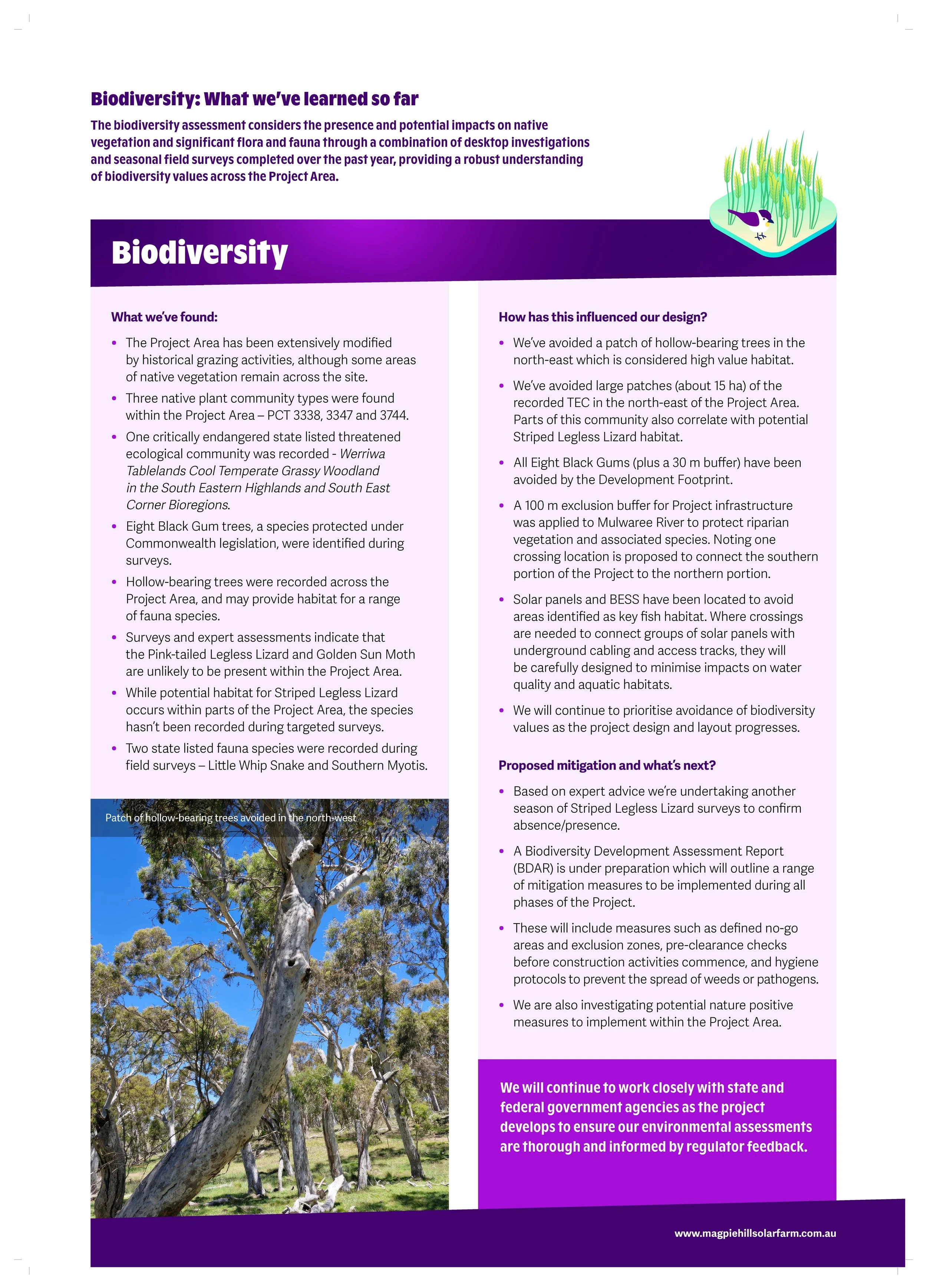
Biodiversity: Presence and potential impacts to native vegetation and significant flora and fauna.
Cultural and historic heritage: Presence and potential impacts to places of Aboriginal cultural heritage value and significance, such as scattered artefacts, burial sites or scarred trees.
Land: Including site suitability, compatibility and impacts
Noise and vibration: Potential noise impacts surrounding sensitive receptors (e.g, homes and other sensitive locations) during construction and operation of the Project.
Landscape character and visual amenity: Potential visual impacts from the Project, including the landscape character, surrounding homes and significant public viewpoints.
Glint and glare: Assesses locations and times where solar reflections may occur and evaluates potential mitigation measures to minimise visual impacts.
Transport, traffic and access: Potential traffic and transport impacts from the Project to the surrounding roads, including disruptions or changes for residents, businesses and tourists.
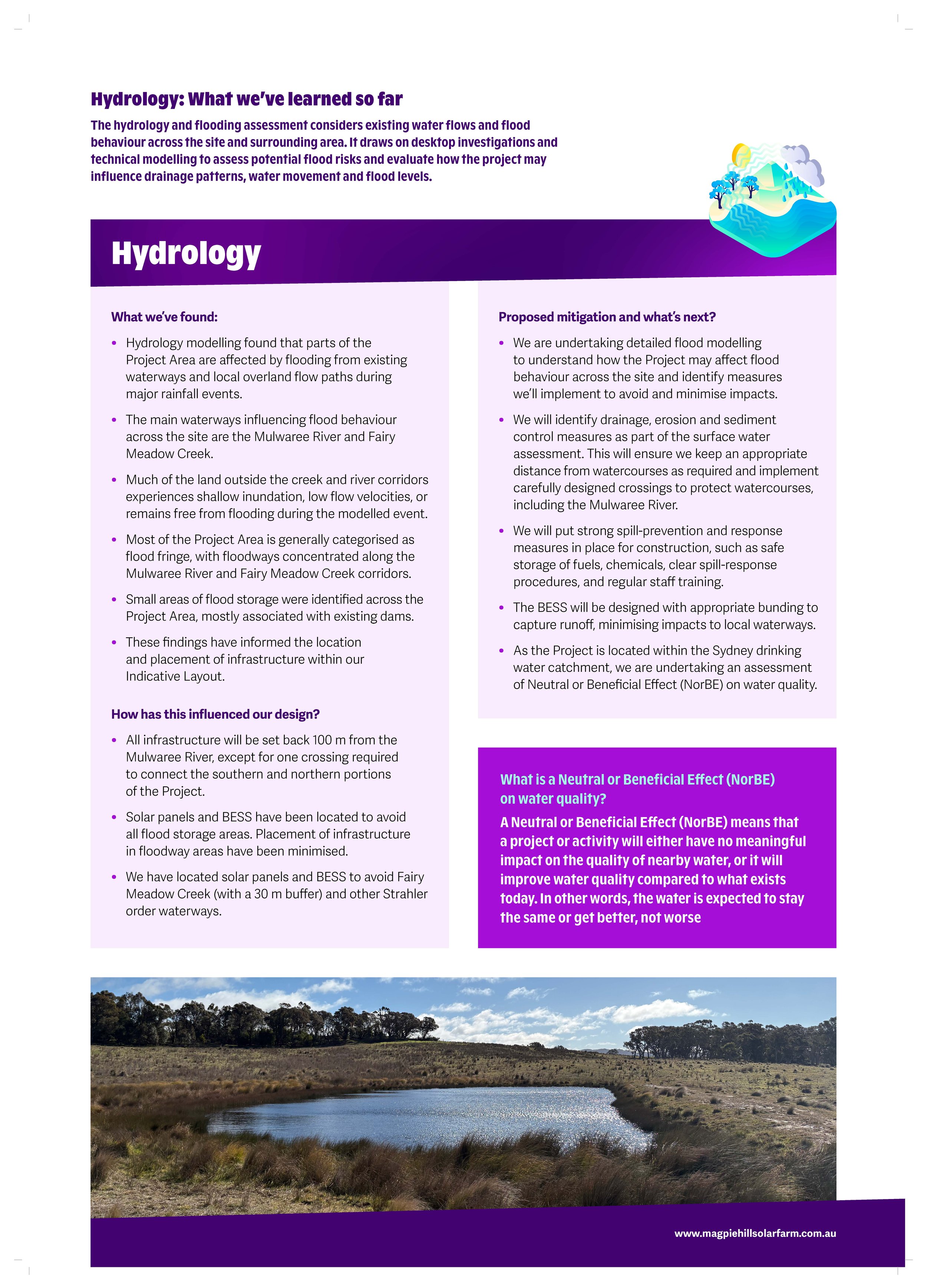
Water and soils: Potential flood risk to the site, including potential changes to surface waterflows from the permanent footprint of the Project.
Hazards and risks: Potential risk of the Project starting or interacting dangerously with a fire as well as other potential hazards, for example chemical leaks or spills.
Social: Assesses the existing social environment and considers community values, demographics and socio-economic conditions to evaluate potential impacts.
Waste: Management of waste generated during construction and operation.
Community consultation will continue alongside these studies. We will regularly share updates on what we are learning and explain how this information is being used to refine the Project and manage potential impacts.
Throughout the preparation of the EIS and the assessment process, there will be multiple opportunities for community members and stakeholders to provide feedback, share local insights, and identify potential environmental or social impacts for consideration. More information on upcoming EIS engagement can be found here. There will also be formal opportunities to make submissions once the EIS is publicly exhibited.
Technical studies will also inform the Project’s requirements under the Environment Protection and Biodiversity Conservation Act 1999 (EPBC Act).
We're undertaking detailed technical studies to better understand the Project's potential impacts and benefits, identify appropriate mitigation measures, and inform the Project's design. As the work progresses, we'll continue to keep the community informed about what we're learning and how feedback and technical investigations are influencing project outcomes.
At our recent community drop-in sessions, we shared a range of maps and information posters outlining the early findings of the technical studies and providing an overview of the work underway. We encourage community members to explore these materials and learn more about the studies being undertaken for the Project. View the posters and maps below.
Technical Studies: What We've Learned So Far
-
![]()
Biodiversity Poster
-
![]()
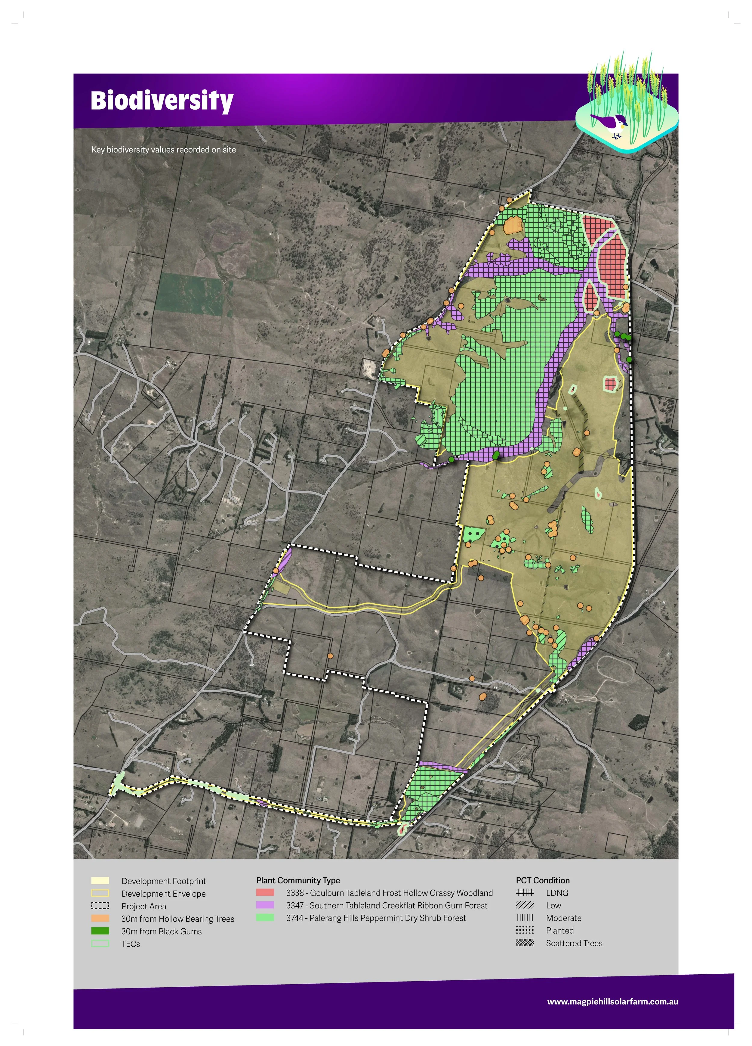
Biodiversity Map
-
![]()
Hydrology Poster
-
![]()
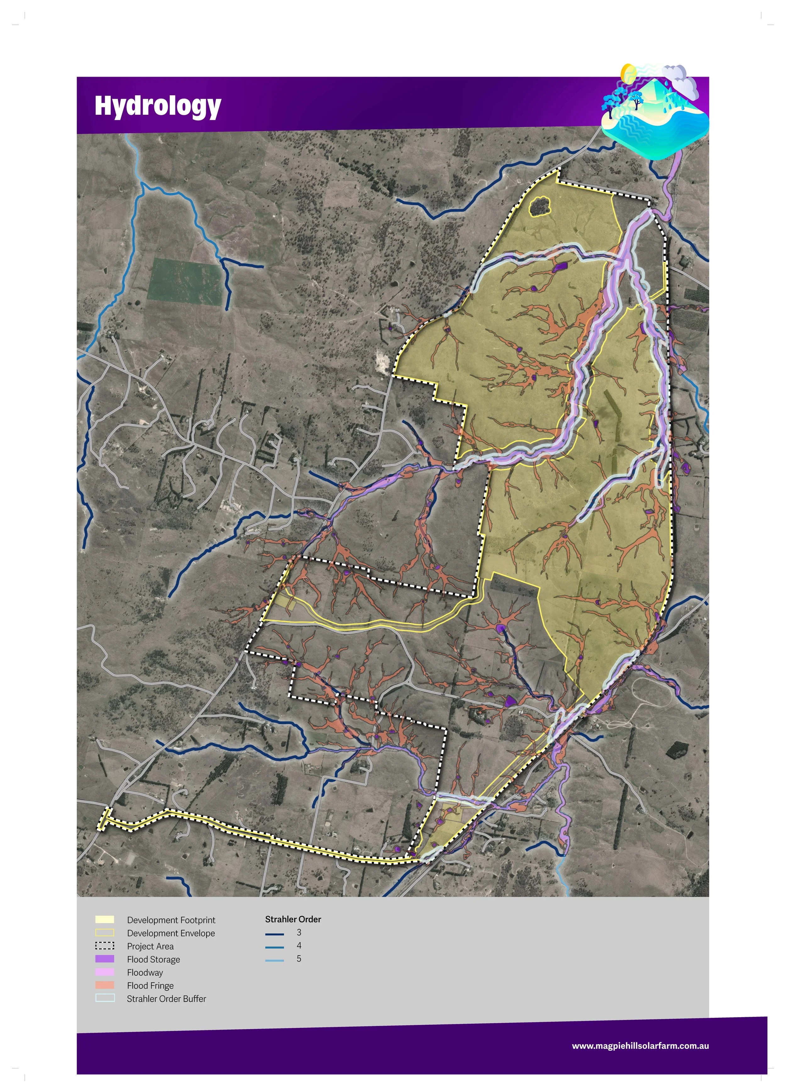
Hydrology Map
-
![]()
Bushfire Risk Poster
-
![]()
Bushfire Risk Design
-
![]()
Landscape & Visual Poster 1
-
![]()
Landscape and Visual Poster 2
-
![]()
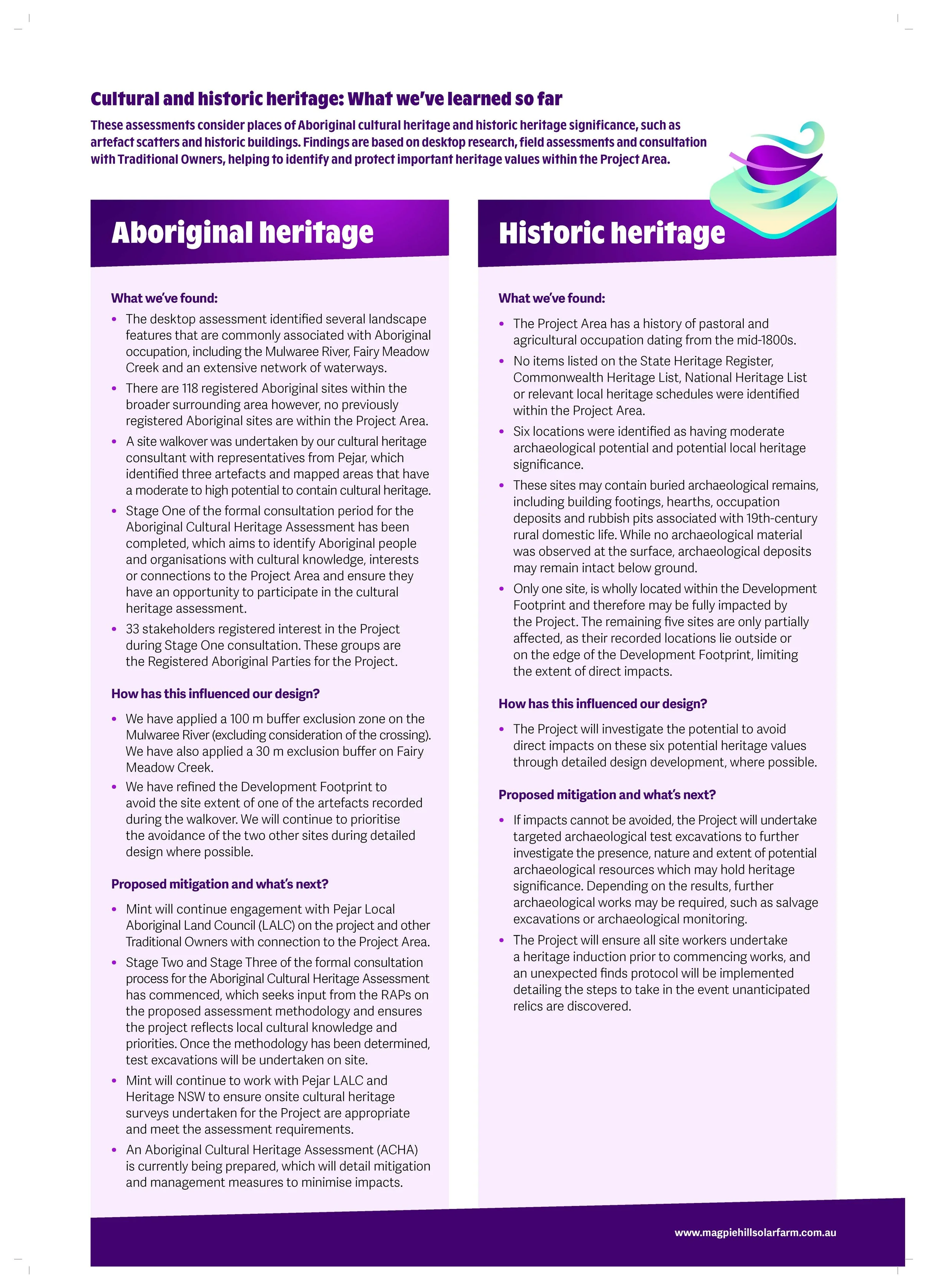
Cultural and Historic Heritage
-
![]()
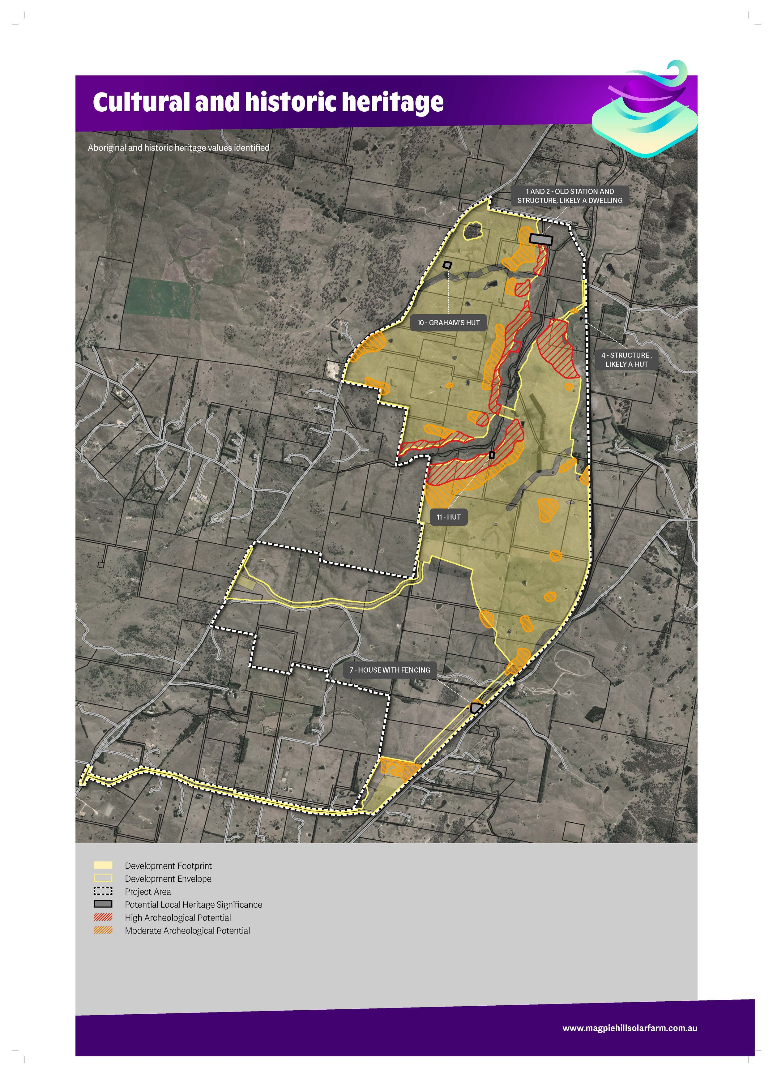
Cultural and historic heritage map
-
![]()
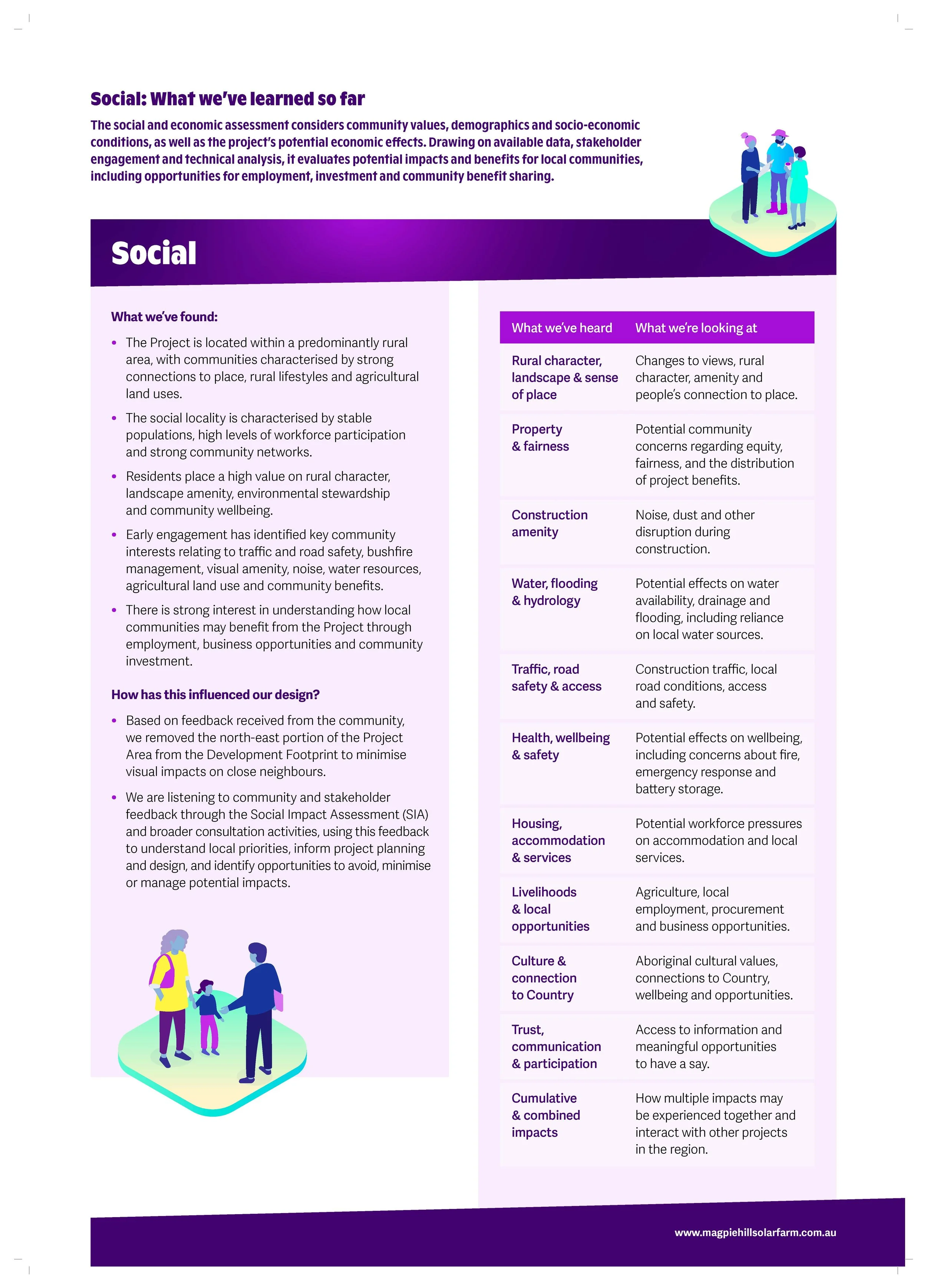
Social
-
![]()
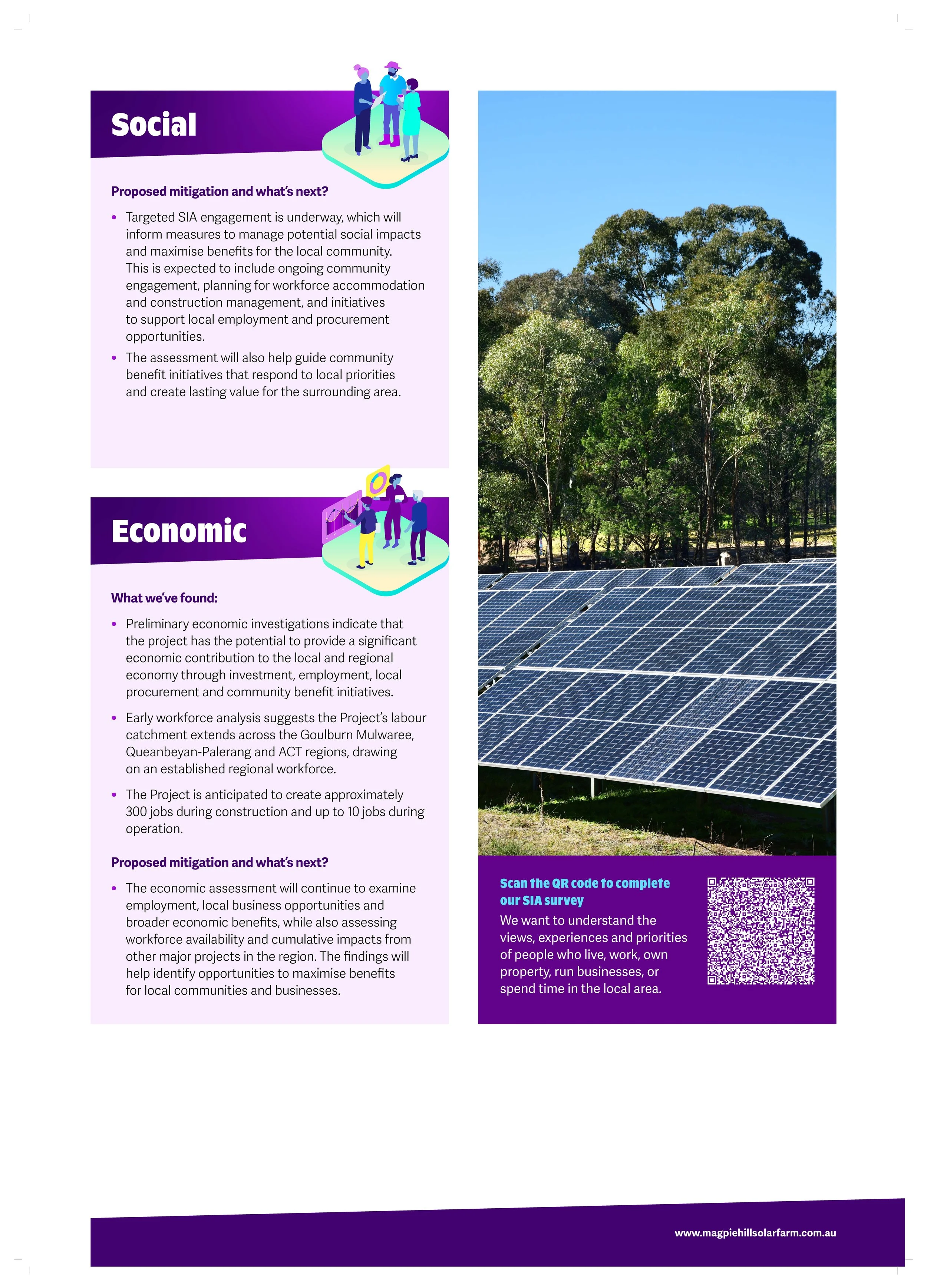
Social and Economic
-
![]()
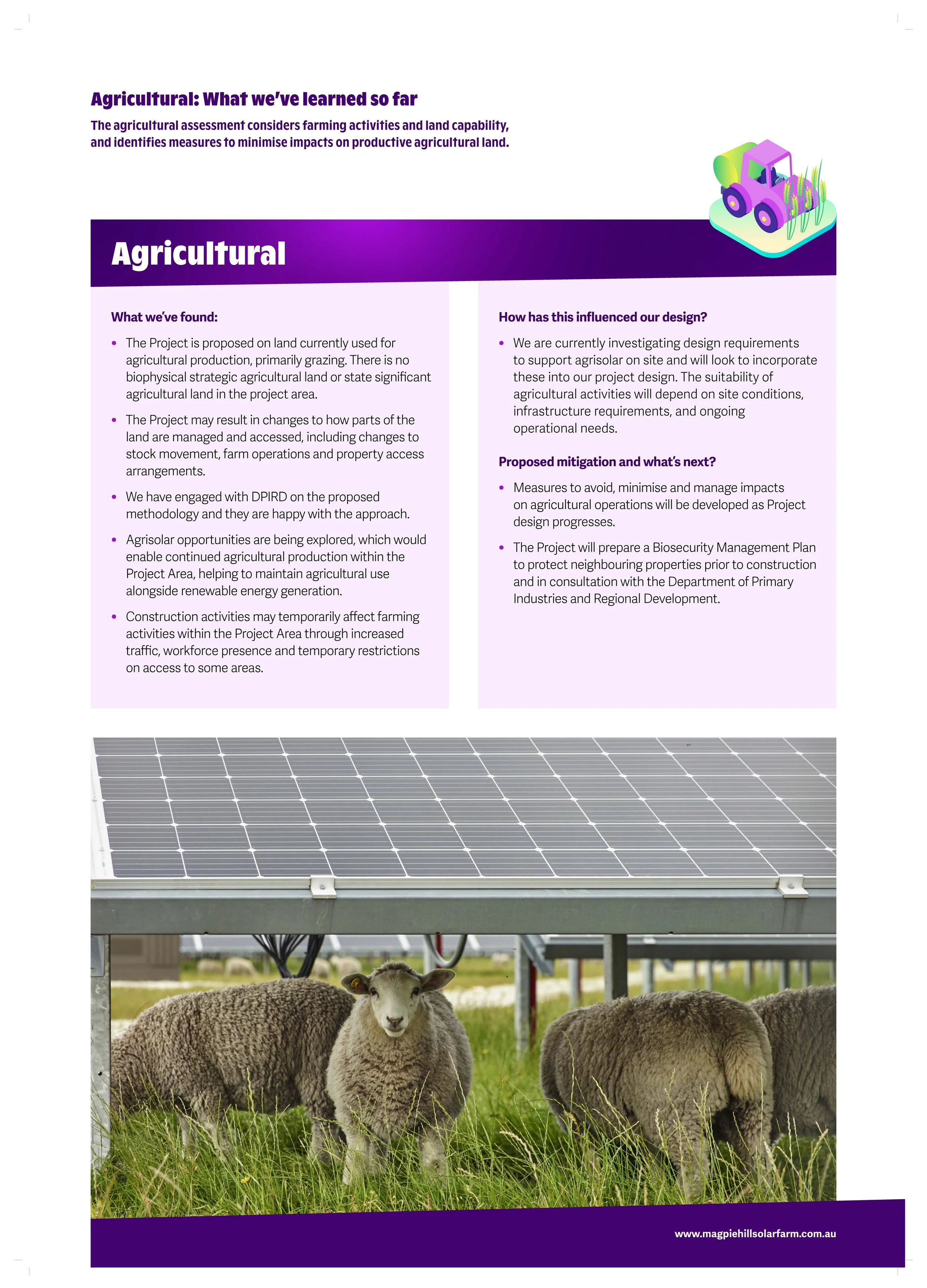
Agricultural
-
![]()
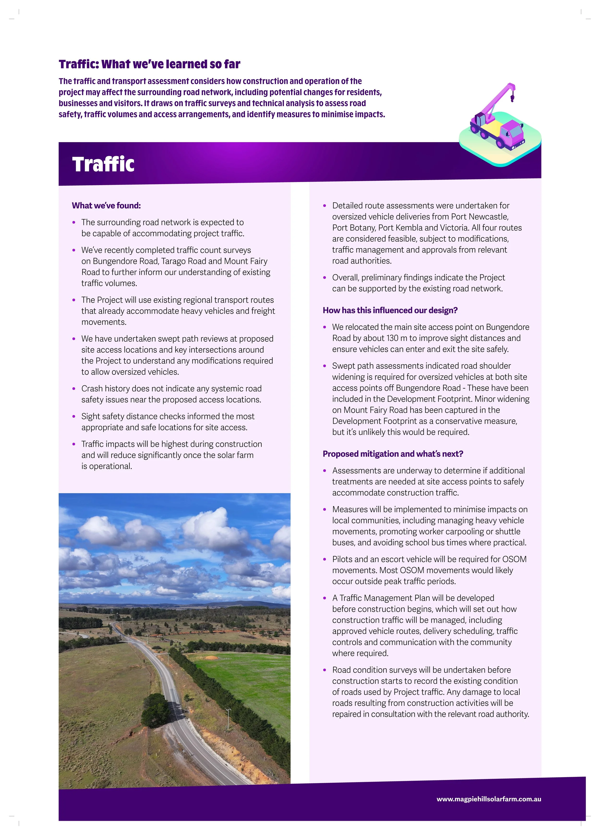
Traffic
-
![]()
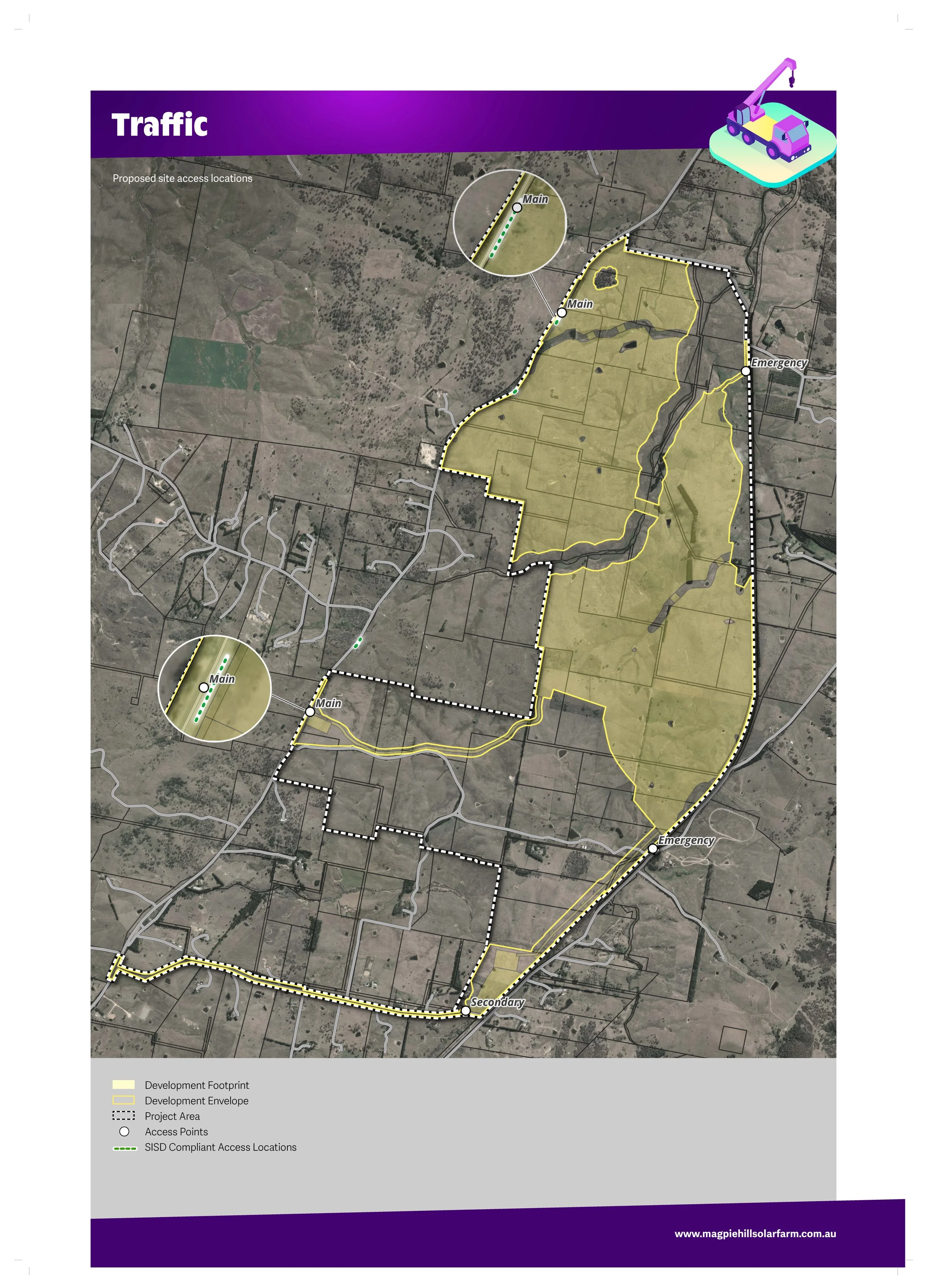
Traffic Map
-
![]()
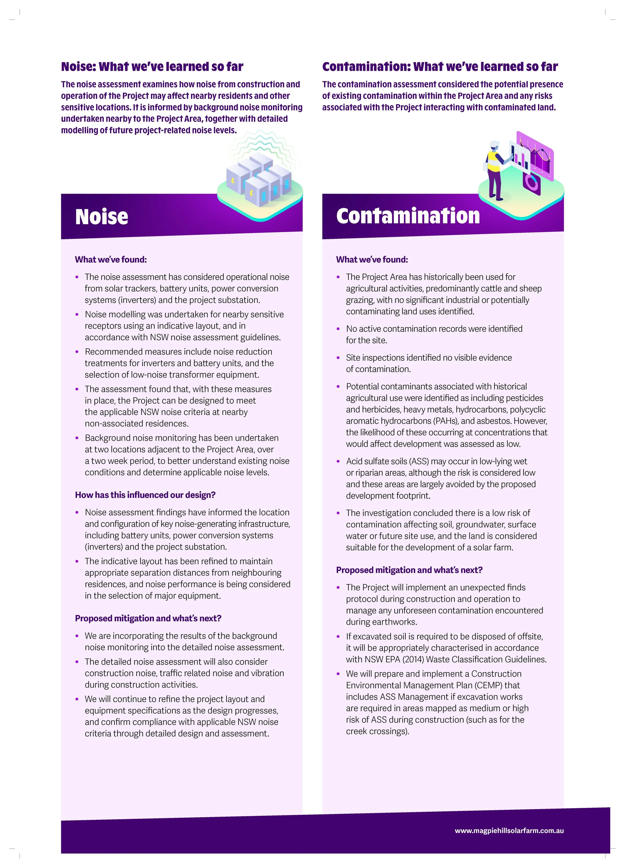
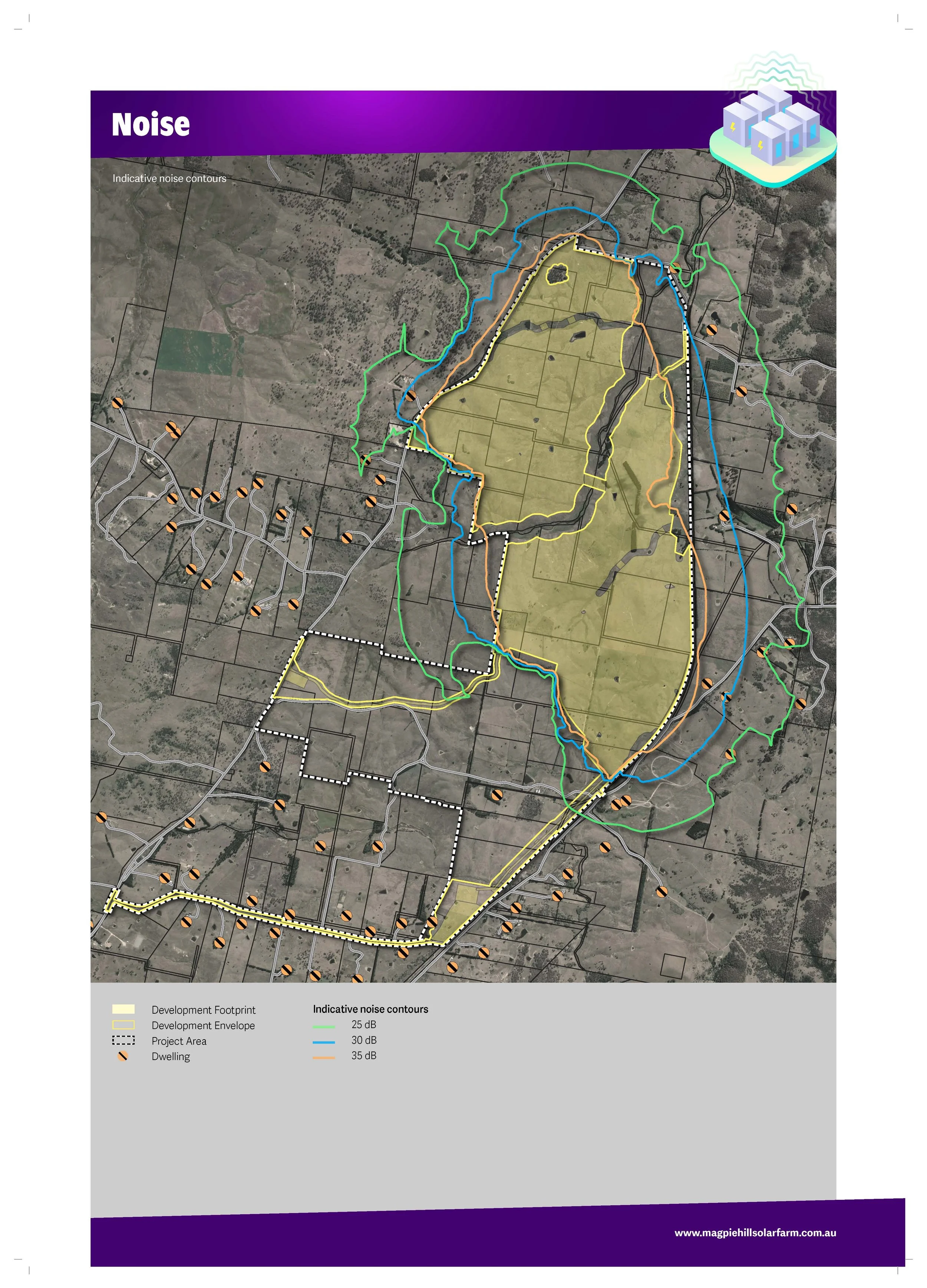
Noise and contamination
-
![]()
Noise Map
We are committed to keeping the community informed and engaging with stakeholders as technical studies progress and the EIS is prepared.
How the Project has changed since we last spoke to you
We're committed to listening and showing how community feedback, together with technical assessments, is helping to shape the Project. Here's what we've heard so far and how the project design has evolved since submission of the Scoping Report:
Protecting biodiversity and important environmental areas
We heard: Protecting native vegetation, wildlife habitat and areas of environmental significance is important to the community.
What we've done: We removed approximately 15 hectares from the development footprint to avoid a threatened ecological community. We have also avoided all identified Black Gum trees, a species protected under Commonwealth legislation and avoided a patch of hollow-bearing trees in the north-west which is considered high value habitat. In addition to our 100m buffer already applied to the Mulwaree River, we’ve applied 30-40m buffers (depending on the Strahler order) to other waterways on site, including Fairy Meadow Creek. We previously proposed two crossings of the Mulwaree River, and have now selected only one to proceed with.
Reducing visual impacts
We heard: Visual impact is one of the key concerns raised by neighbours and the broader community.
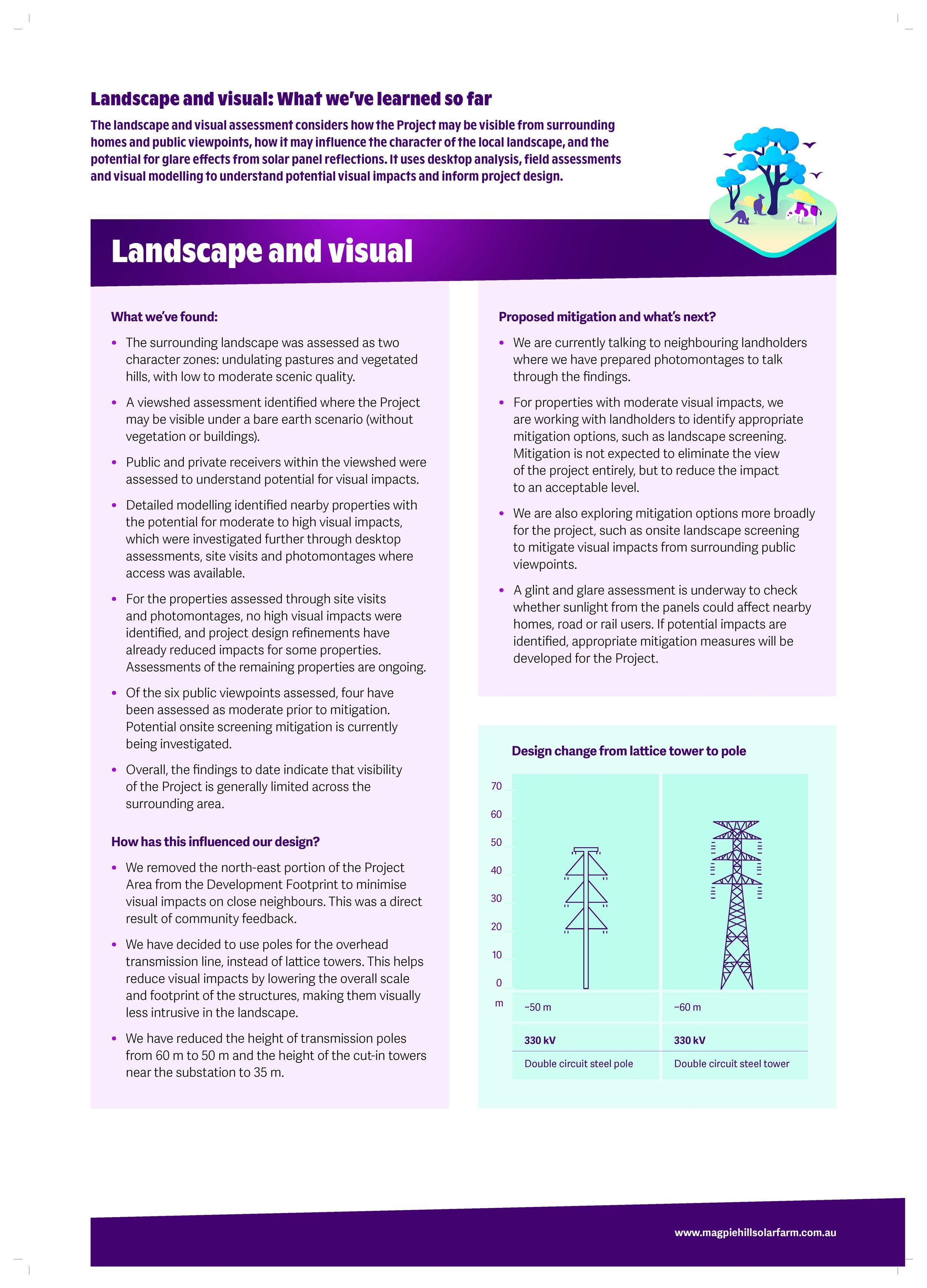
What we've done: We removed the north-east portion of the project area from the development footprint to reduce impacts on nearby residents. We have also chosen transmission poles rather than larger lattice towers. We originally proposed transmission poles with a height of 60 m. However, following detailed visual assessments and photomontage modelling from neighbouring properties, the proposed transmission pole height has been reduced to 50 m. The cut-in towers near the substation have also been reduced in height, from 60 m to 50 m and 35 m. We hosted a webinar where project specialists will share how visual impact assessments are being used to shape the design, present updated visual simulations, and answer questions from the community. See below for the recording.
Improving road safety and access
We heard: Traffic, road safety and the condition of local roads are important considerations for the community.
What we've done: Traffic assessments have informed changes to site access arrangements, including relocating the proposed main access point to improve sight distances and vehicle safety. Further traffic studies are underway to identify any additional road improvements or management measures that may be required.
Managing bushfire and safety risks
We heard: Community members want to understand how bushfire and battery safety risks will be managed.
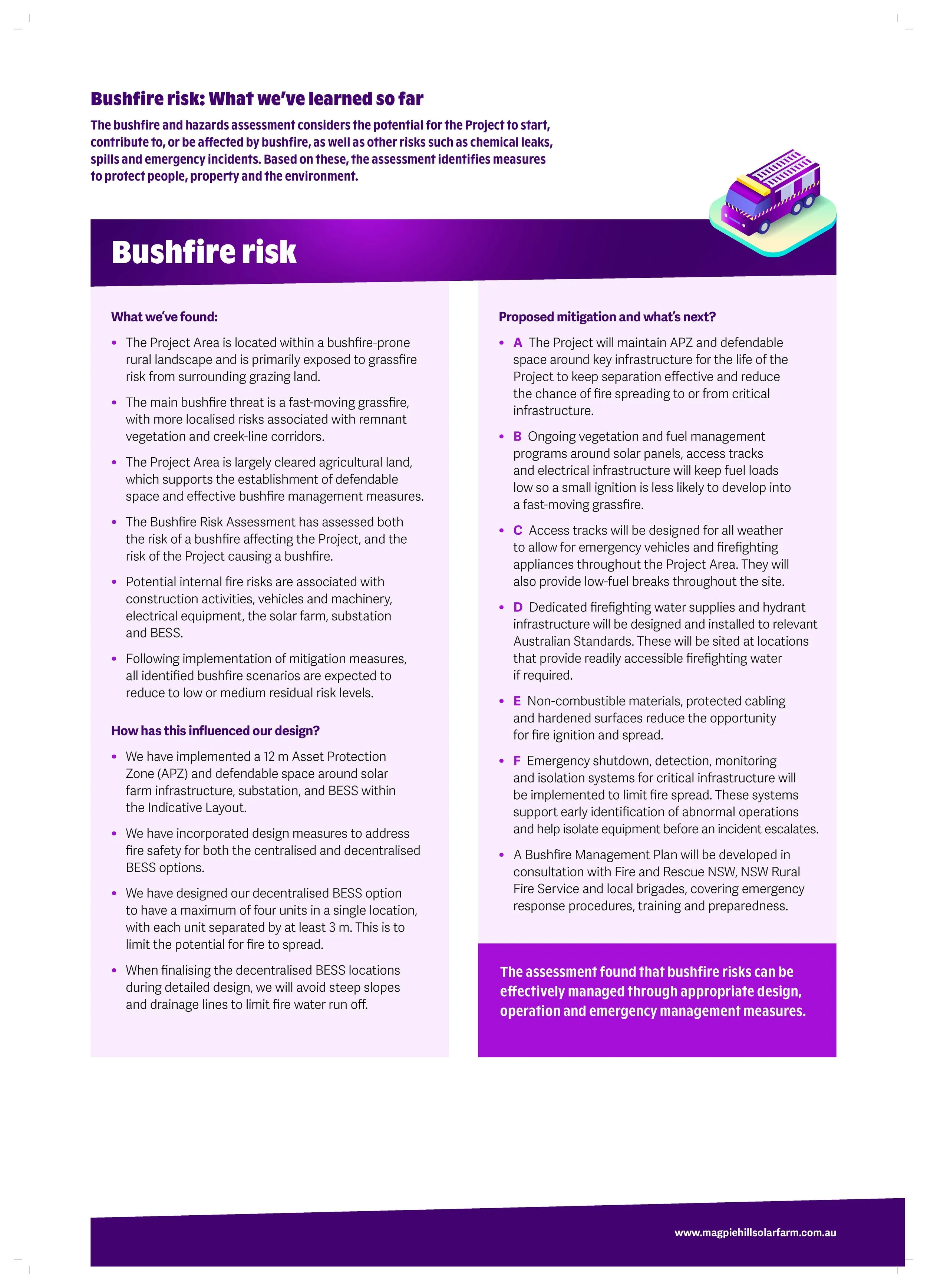
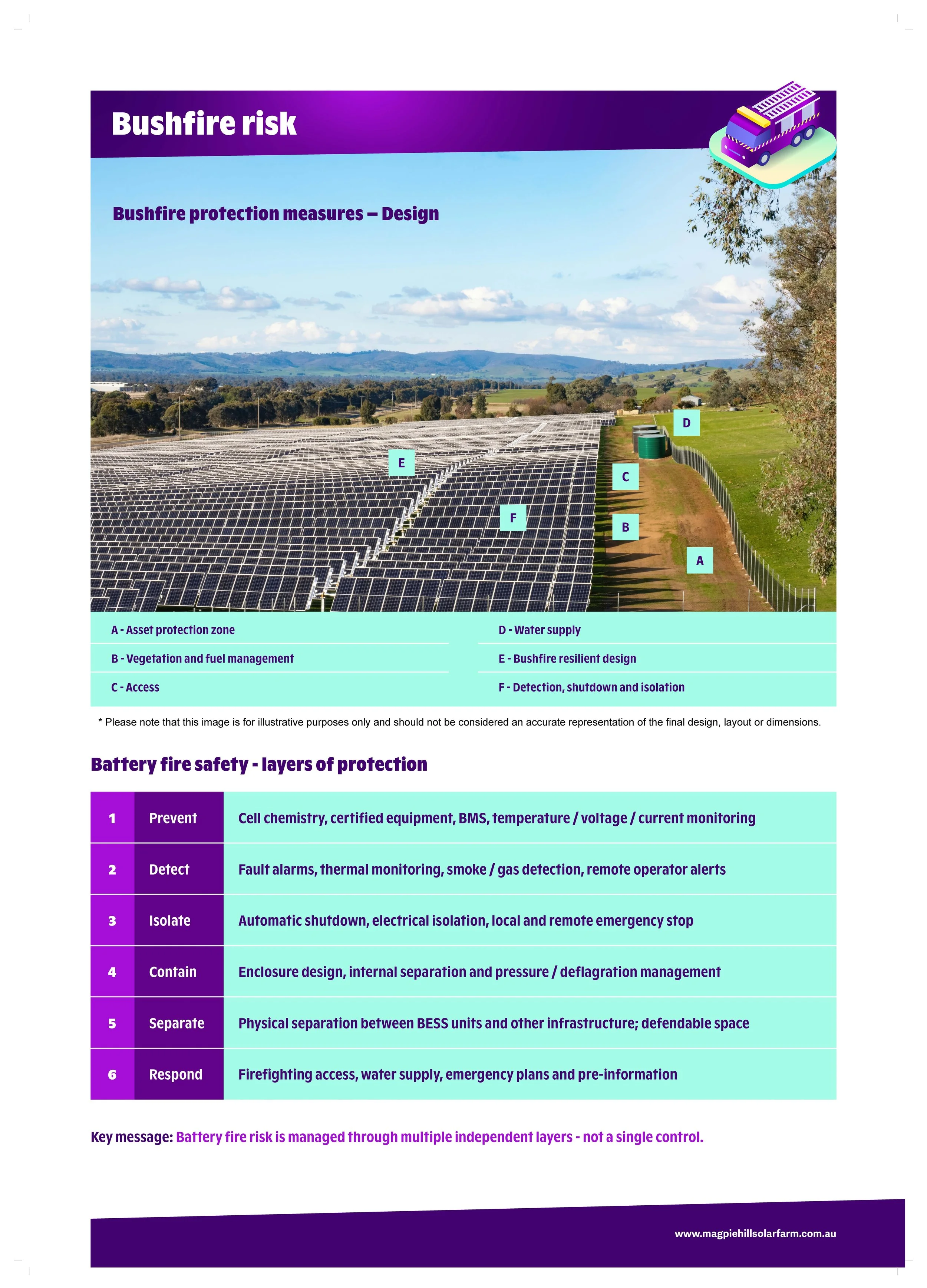
What we've done: Based on recommendations made by our specialist bushfire consultant, we have implemented an 12m Asset Protection Zone (APZ) and defendable space around solar farm infrastructure, substation, and BESS. We have designed the decentralised BESS option to limit the number of units located together in any one area, with appropriate spacing between units to limit the potential for a fire to spread. We’re continuing to incorporate fire safety design measures into the project, including dedicated firefighting water supplies, and ensuring access tracks allow for safe use by emergency vehicles
We hosted a technical webinar with our bushfire specialist to explain how bushfire and battery safety risks are being assessed and managed, and to provide an opportunity for community members to ask questions directly. See below for the recording.
Flooding and hydrology
We heard: Concern about locating infrastructure in flood‑affected areas, potential changes to surface water flows.
What we've done: We’ve designed our layout to locate solar panels and BESS to avoid all flood storage areas. Placement of infrastructure in floodway areas have been minimised. We’re currently undertaking detailed flood modelling to understand how the Project may affect flood behaviour across the site and identify measures we’ll implement to avoid and minimise impacts.
Noise
We heard: Noise impacts from the substation and BESS is a key concern amongst the community.
What we've done: We’ve designed the location and configuration of key noise-generating infrastructure, including battery units, power conversion systems (inverters) and the project substation based on noise assessment findings. The indicative layout has been refined to maintain appropriate separation distances from neighbouring residences, and noise performance is being considered in the selection of major equipment.
Aboriginal Cultural Heritage
We heard: Protecting cultural heritage and understanding connections to Country were identified as important considerations through engagement with First Nations stakeholders and the broader community. Feedback highlighted the importance of understanding cultural values and avoiding impacts on areas of cultural significance wherever possible.
What we've done: Cultural heritage surveys carried out with Pejar identified three artefact sites within the project area and highlighted areas that may contain additional cultural heritage values. We have already adjusted the project to avoid one of these sites and will continue to prioritise avoiding the other two sites during the detailed design stage where possible.
Supporting agriculture
We heard: Maintaining productive agricultural land is important to the local community.
What we're doing: We're assessing opportunities for agrisolar, allowing agricultural activities such as livestock grazing to continue alongside renewable energy generation where practical and suitable.
Creating lasting local benefits
We heard: Community members want to understand how the Project could contribute positively to the local area and deliver benefits that reflect community priorities.
What we're doing: We're committed to working with the community to develop a benefit sharing program that delivers lasting value to the region. This includes exploring opportunities such as community funding, local employment, support for local businesses, neighbour benefit initiatives, training and education opportunities, and other programs that respond to local needs and priorities. Community feedback will continue to help inform the development of this program as the Project progresses.
Further refinements to the Project design, layout and mitigation measures will be made as detailed studies progress and consultation continues. This iterative process ensures that community feedback, alongside technical assessments, continues to inform decisions and helps to avoid or minimise environmental, social and amenity impacts wherever possible.
Community feedback continues to inform technical studies, project design and mitigation measures as we prepare the Environmental Impact Statement (EIS). We'll continue sharing what we're learning, what decisions are being made, and how community feedback is helping to shape the Project.
Engagement
Community consultation remains an important part of the Environmental Impact Statement (EIS) process. Throughout the preparation of the EIS, we have been engaging with the community to share information about the Project, provide updates on technical studies, and gather local knowledge and feedback to help inform the assessment process.
Over recent months, the Project team has undertaken a range of engagement activities, including:
Two online technical webinars focused on fire risk and amenity.
A pop-up information session.
Three community drop-in sessions in Bungendore and Tarago.
Community consultation to inform the Social Impact Assessment (SIA).
These activities provided opportunities for community members, neighbouring landholders and other stakeholders to learn more about the Project, hear from technical specialists, ask questions, and share feedback on matters of local importance. We thank everyone who participated and contributed their views.
Community Drop-in Sessions
Thank you to everyone who attended our recent community drop-in sessions in Bungendore and Tarago in early September. These sessions provided an opportunity for community members, neighbouring landholders and other stakeholders to meet with the Project team, learn about the studies informing the Environmental Impact Statement (EIS), discuss early findings, and share questions, feedback and local insights. We appreciate the feedback received and will continue to consider community input as the EIS studies progress.
Missed the Sessions?
We welcome your feedback at any time. Contact the team directly to ask questions and share your views as the assessment process continues.
Mint is committed to keeping the community informed and will continue to share project updates through this website and with subscribers as the project progresses through the planning and assessment process. Sign up to our newsletter to stay up to date with the Project, including opportunities to provide formal feedback during EIS exhibition.
Technical Webinar Recordings
Thank you to everyone who joined our recent technical webinars on bushfire risk and landscape and visual amenity. These sessions provided an opportunity for community members and stakeholders to hear directly from independent technical specialists about the studies being undertaken to inform the Project's Environmental Impact Statement (EIS).
We appreciate everyone who participated, asked questions, and shared their feedback. Your input is valuable and is being considered as part of the ongoing assessment process and the continued refinement of the Project design.
If you were unable to attend, or would like to revisit the presentations, recordings of both webinars are available below. We encourage you to watch the sessions and stay involved in the Project by participating in upcoming community engagement and consultation opportunities.
For the best viewing experience, select the full-screen icon (four arrows) in the bottom-right corner of the video player.
Technical Webinar: Fire | Wednesday 26 August, 6:00pm-7:00pm
Mark is the Managing Director of Agilus, an organisation specialising in fire risk assessments for renewable energy developments. Mark has over 30 years of experience as a strategic fire risk consultant with deep expertise across bushfire risk assessments, emergency management, environmental planning and renewable energy sectors. This depth of experience enables Agilus to deliver practical fire risk mitigation strategies that work in real-world conditions.
Technical Webinar: Amenity| Tuesday 02 September, 6:00pm-7:00pm
Chris is the Principal Acoustic Engineer and founder of Sonus, providing specialist acoustic services since 2002. Sonus has a national reputation for technical excellence and for providing clear, superior advice on acoustic issues. Chris has achieved a highly regarded reputation across all sectors in his more than 30 years experience in acoustics, which has included several renewable energy projects including, wind solar and battery.
Ashley is the Director of Moir Studios, a respected industry leader in Landscape and Visual Impact Assessment for renewable energy developments. As a Registered Landscape Architect with over 15 years of experience, she has led visual assessment and landscape planning studies for major wind, solar and infrastructure projects throughout Australia. Ashley is regularly engaged to provide expert advice on visual impact assessment and has contributed to the development of planning policy through her work with the NSW Department of Planning and Environment, including the peer review of draft wind and solar farm guidelines and other planning policies.
Environmental Impact Statement (EIS) - Frequently Asked Questions
-
Community and stakeholder feedback is already shaping the Magpie Hill Solar Farm. Feedback from neighbours and the community during the Scoping phase has directly informed design refinements, including how we're considering noise, visual and biodiversity impacts. As we prepare the EIS, your feedback continues to help us focus technical studies on the issues that matter most to you, identify mitigation measures, and shape how we engage going forward.
-
Giving feedback now through the Project’s surveys, drop-in sessions or contacting the project team, can help shape the Project and the EIS before it's finalised. Making a formal submission during public exhibition (after lodgement) is a separate, statutory process where your comments go directly to the Department of Planning, Housing and Infrastructure (DPHI) as part of their assessment. Both matter- early feedback can influence the Project's design and approach, while a submission is your formal input into the government's decision-making process.
-
The EIS is a comprehensive technical document prepared in line with the SEARs, so it isn't released in draft form for public comment before lodgement. However, we'll continue to share what we're learning through technical assessments as we go and explain how that information is being used to shape the Project.
-
Not every individual suggestion can be adopted, but all feedback is carefully considered. Feedback has already led to real changes for example, early concerns about noise, visual and biodiversity impacts directly informed design refinements during the Scoping phase. We're committed to being transparent about what we've heard and how it's being used.
-
The Project's EIS is expected to be lodged with DPHI towards the end of 2026, with exhibition to follow once DPHI has completed its review. We'll confirm exact dates via our newsletter and this page as soon as they're set.
-
You can make a formal submission once the EIS is placed on public exhibition by the NSW Department of Planning, Housing and Infrastructure. During this period, the EIS and supporting documents will be available for community members to review.
Looking for more information? View Project Resources and FAQs

Mint Renewables will engage meaningfully with First Nations people of Australia and mana whenua of Aotearoa to develop long term relationships based on respect and understanding. Mint Renewables acknowledges the Traditional Custodians of country and their continuing connection to land, waters and community. We pay our respects to their Elders past and present.